
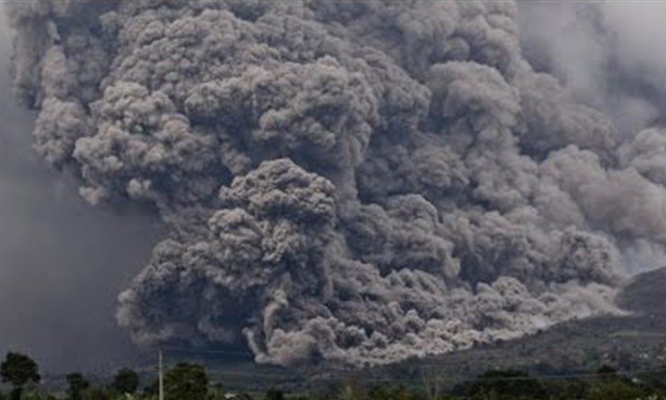
Mount Sinabung erupts!
The Mount Sinabung volcano in Indonesia’s North Sumatra province erupted on Thursday 2nd April 2015, afternoon, emitting a column of hot ash 1.5 miles into the sky.
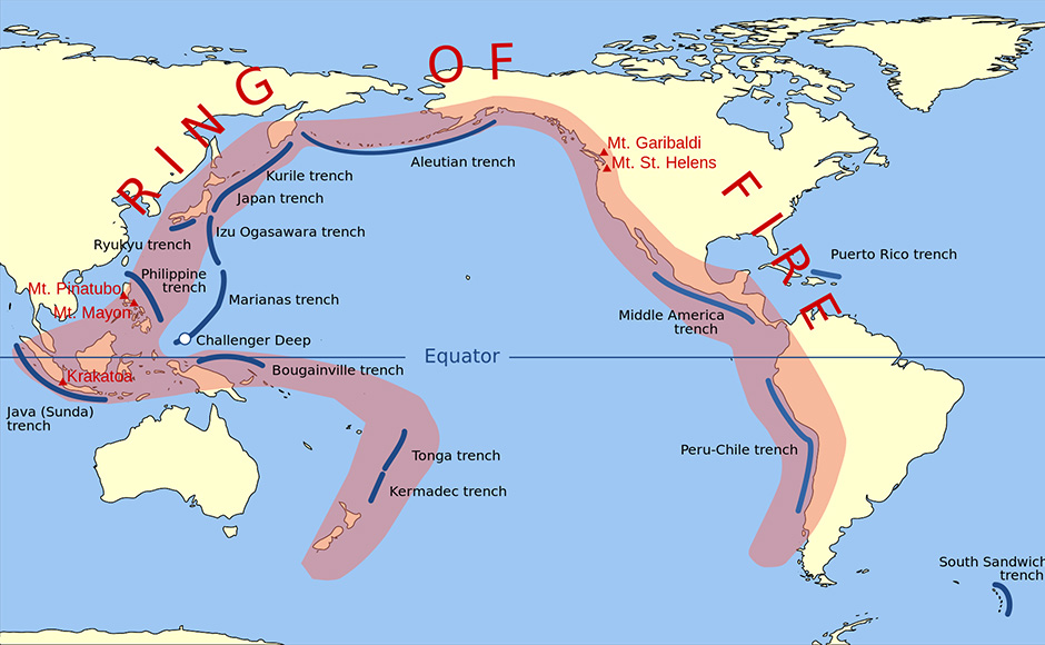
Mount Sinabung is one of the 120 active volcanoes in Indonesia, which has seismic cataclysms due to its location on the ‘Pacific Ring of Fire’, where a large number of earthquakes and volcanic eruptions occur in the basin of the Pacific Ocean spanning 25miles in the shape of a horseshoe. It is linked to a series of oceanic trenches, volcanic arcs and volcanic belts. The Ring of Fire is the direct result of plate tectonics and collisions of lithospheric plates.
A powerful burst of hot ash was dispersed from the reverberating volcano, spanning 3 miles to the south of the crater and half a mile to the southeast, according to Sutopo Purwo Nugroho, spokesman for the National Disaster Management Agency. Most of the panic stricken villagers living near the volcano were evacuated to safer places, Sutopo said. Lava floods damaged roads.
In the past, 2,475-metre Mount Sinabung had erupted on June 29 after erupting on and off from September 2013 to February 2014, which left 15 people dead and more than 30,000 others internally displaced.