
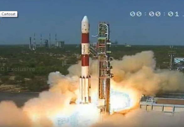
Cartosat launched by India
India has successfully put into orbit its own earth observation satellite Cartosat weighing 712kg, nano satellite NIUSAT and 29 foreign satellites weighing 243 kg from Austria, Belgium, UK, Chile, Czech Republic, Finland, France, Germany, Italy, Japan, Latvia, Lithuania, Slovakia and the US. The entire mission was completed in 23 minutes.
According to ISRO, the images sent by Cartosat satellite would useful for Cartographic, urban, rural, coastal land use, utility management like road network, monitoring, water distribution, the creation of land use maps. The satellite will also provide multi-spectral imagery for agricultural crop monitoring and disaster management support applications.
At 1:00 BST (9:29 IST) the 320-tonne PSLV rocket 44.4 meters tall, zoomed into the morning skies with orange flames at its tail.